Lamar River Trail
| Trail Features: | Scenic Views, Wildlife, Wildflowers | 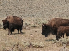 |
|||
| Trail Location: | Lamar Valley | ||||
| Roundtrip Length: | 8.6 Miles | ||||
| Trailhead Elevation: | 6675 Feet | ||||
| Total Elevation Gain: | 785 Feet | ||||
| Avg. Elev Gain / Mile: | 183 Feet | ||||
| Highest Elevation: | 7040 Feet | ||||
| Trail Difficulty Rating: | 10.17 (strenuous) | ||||
| Parking Lot Latitude | 44.86922 | ||||
| Parking Lot Longitude | -110.16624 | ||||
Trail Description:
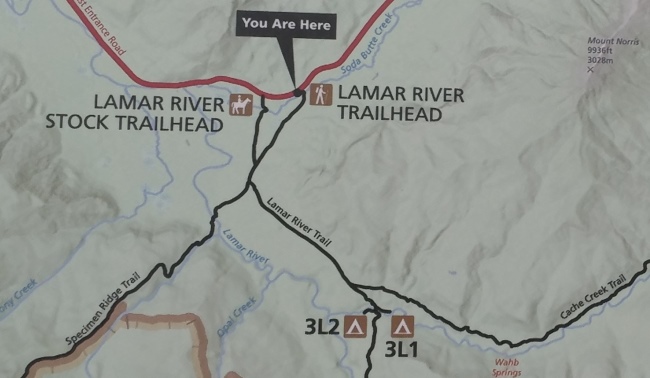
The hike along the Lamar River Trail in Yellowstone National Park begins from the Lamar River Trailhead, located roughly 15 miles east of Tower Junction on Northeast Entrance Road. This trailhead is also sometimes referred to as the Soda Butte Trailhead. You may also want to note that the Lamar River Stock Trailhead is located roughly one half-mile to the west of the hiker’s trail.
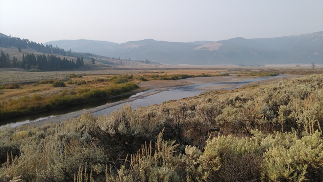
The following describes a hike that visits the banks of both the Lamar River and Cache Creek. The hike forms a “Y” that provides hikers with an excellent opportunity to explore the upper Lamar Valley, often referred to as the “American Serengeti”. The valley is home to a wide variety of wildlife, and provides hikers with an excellent opportunity to see bison, pronghorn, elk, bears, and even wolves.
After walking less than one hundred yards hikers will cross the footbridge over Soda Butte Creek. This section of the hike provides sweeping views of the Absaroka Mountains towards the east, and the Lamar Valley towards the west.
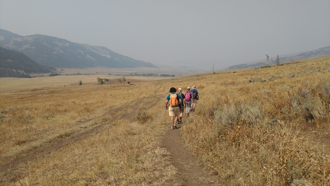
From the footbridge the trail cuts a southwesterly course towards the Lamar River through grassy and sagebrush meadows. At just over 1.1 miles from the trailhead hikers will reach the Lamar River Stock Trail junction. You should proceed straight ahead to continue along the main trail. At just over 1.3 miles you’ll reach the Specimen Ridge Trail junction. From this junction this hike will eventually proceed in both directions to visit the two streams. For this hike we chose to visit the Lamar River first, which is located roughly seven-tenths of a mile away by continuing straight ahead (right fork) onto the Specimen Ridge Trail.
As with the first segment of the hike, the Specimen Ridge Trail travels over mostly flat terrain, though there are a couple of low hills you'll need to ascend along the way. With the exception of your time at the Lamar River, the entire hike passes through open meadows, with complete exposure to the sun and any other weather events. The Specimen Ridge Trail is crossed by several bison paths, and passes several bison wallows. During this stretch we saw a couple of bison grazing across the valley, as well as a wolf in the far of distance.
At roughly 2 miles the trail reaches the edge of a low bluff. At first glance, with several social trails and/or bison paths in the area, it’s not entirely clear how to proceed down to the river. Look for a series of yellow tags on the trees in this valley, which will lead you down to the river bank.
When you arrive at the river you may want to have your bear spray handy, and be sure to make your presence known by making lots of noise. At the river we saw several signs of bear activity, including a couple of footprints leading out of the river, several trees with scratch marks, as well as hair on a couple of trees where bears had rubbed their backs.
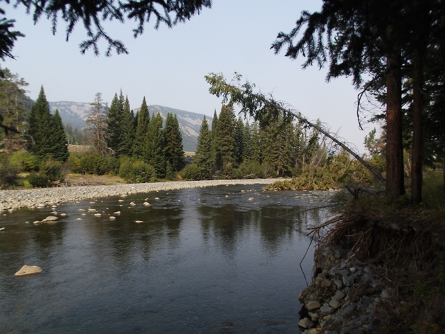
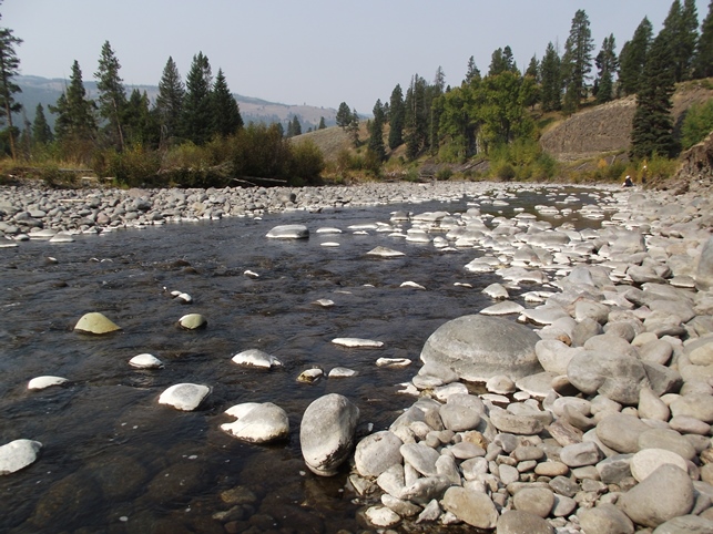
The Lamar River is recognized as being one of the most popular fishing streams in the park, especially for Yellowstone cutthroat trout. The river flows out of the Absaroka Mountains for roughly 40 miles before emptying into the Yellowstone River near Tower Junction.
After soaking in the views along the banks of the river, simply retrace your steps back to the previous trail junction. From the junction, turn right to head uphill along the Lamar River Trail to proceed towards Cache Creek. This trail ascends along a moderate grade towards the upper portions of the Lamar Valley. After about a mile and a half it tops out at roughly 7040 feet in elevation. From the top of the hill the trail begins a moderate descent down towards the Cache Creek valley. At just over 4.5 miles the trail reaches the Cache Creek Trail / Lamar River Trail junction. Hikers should veer right to remain on the Lamar River Trail to continue towards Cache Creek. Despite the names of the two trails, this is the most direct route to the creek. The Cache Creek Trail loosely follows the creek upstream for several miles.
As you approach the creek the trail passes a large aspen grove. The last tenth-of-a-mile down to the creek is fairly steep. At this junction with Cache Creek you’ll likely notice the curious looking white stones that line the stream here. From this point the creek empties into the Lamar River roughly a half mile further downstream.
As you may have noticed, our photos were marred by thick smoke from massive forest fires in California, Oregon and Idaho during our most recent trip. Normally the scenery throughout this valley is outstanding. As mentioned above, the main focus of this hike is the opportunity to see a variety of wildlife. During our hike we saw a wolf, bison, pronghorn, hawks, mountain bluebirds, and were alerted about the sighting of a bald eagle on the Lamar River only minutes before arriving there. During the spring and early summer months, hikers will also enjoy a plethora of wildflowers as they pass through the grassy and sagebrush meadows.
Additional Resources:
* Yellowstone National Park website
* Trail Map (trails are not included on the official park map)
* Lonely Planet Yellowstone & Grand Teton National Parks