Avalanche Peak
| Trail Features: | Outstanding Views | 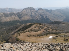 |
|||
| Trail Location: | East Entrance Road | ||||
| Roundtrip Length: | 4.7 Miles | ||||
| Trailhead Elevation: | 8480 Feet | ||||
| Total Elevation Gain: | 2100 Feet | ||||
| Avg. Elev Gain / Mile: | 894 Feet | ||||
| Highest Elevation: | 10,568 Feet | ||||
| Trail Difficulty Rating: | 8.90 (moderate-strenuous) | ||||
| Parking Lot Latitude | 44.4707 | ||||
| Parking Lot Longitude | -110.14252 | ||||
Trail Description:
The hike to Avalanche Peak in Yellowstone National Park begins from the Avalanche Peak Trailhead, located roughly 19 miles east of Fishing Bridge Junction, and 8 miles west of the East Entrance. Look for a pullout on the south side of the road, just west of Eleanor Lake. The trailhead is located across the road from the parking area.
From the road the trail immediately begins to ascend through a beautiful mixed forest of pine, spruce and fir, and eventually whitebark pine as you proceed higher. The route soon becomes a strenuous slog, without the help of any flat sections or switchbacks.
At roughly eight-tenths of a mile the trail begins passing through the ghostly remnants of a whitebark pine forest where many trees have died as a result of a mountain pine beetle outbreak. At roughly 1.2 miles the trail emerges above the treeline at the base of a large bowl below the southeastern slopes of Avalanche Peak. After a brief respite from the relentless climb the trail makes a wide turn towards the left, and then immediately begins ascending the talus slopes along the southern flank of the peak. There are a few sections along this stretch where the path becomes fairly narrow, with some exposure to steep drop-offs. As long as you’re careful you shouldn’t have any problems here. If there’s a threat of bad weather, or you have a fear of heights, you may not want to proceed beyond this point.
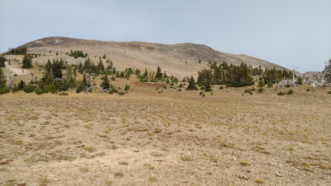
At 1.7 miles, after ascending the steepest section of the route, hikers will reach a meadow lying just below the face of the mountain. From here you can see the trail as it makes its way along the southern flank of the peak. The summit can be seen in the photo below. It’s the most prominent hump just towards the right of the center of the photo. From this meadow the false summit appears most prominently. The actual summit is located immediately behind and to the right of the false summit from this vantage point.
It was in this exact spot in 2001 that I saw my first grizzly bear while hiking. The park website notes that grizzly bears are known to frequent this area during the fall because they are seeking whitebark pine nuts to help fatten up for the long winter ahead. In fact, the park recommends that you shouldn’t even hike this trail in September or October due to high bear activity. Although we’ve hiked this trail in September on two separate occasions, we were in groups of 4 and 5. As always, you should make a lot of noise and carry bear spray while hiking anywhere in Yellowstone.
At just over 2 miles the trail reaches the narrow ridge leading to the false summit. Although you might think this is the highest point on the mountain, you won’t realize this until after reaching the crest of this sub-peak. From the top of the false summit, the true summit is still a little more than a tenth-of-a-mile away. While some might think the two pinnacles are equal in height, the true summit is roughly 10 feet higher than the sub-peak.
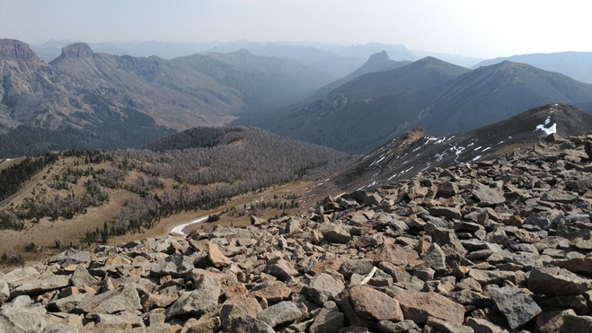
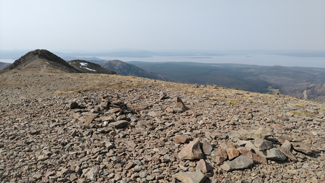
From the top of the mountain hikers will enjoy stunning panoramic views. Most prominently are the rugged Absaroka Mountains towards the north, east and south. Towards the west is Yellowstone Lake, and on a clear day you can even see the Grand Teton Range towards the southwest.
Unfortunately our views, and therefore our photos, were marred by smoke from massive forest fires in California, Oregon and Idaho during our most recent trip. However, I can say for certain, based on our previous ascent, the views are some of the best in Yellowstone National Park.
Hikers should always be aware of lightning risk while hiking in the mountains. As a general rule of thumb you should plan to turnaround before noon in order to avoid the notorious afternoon thunderstorms that frequent the mountains during the summer months. Hikers should also be prepared for extreme sun exposure, high winds, cool temperatures, and rapidly changing weather conditions while on this trail.
Hikers should also note that snow and ice can linger along the upper elevations of the mountain through early July. Early season hikers should check on trail conditions with a ranger before deciding to hike this mountain.
Additional Resources:
* Yellowstone National Park website
* Trail Map (trails are not included on the official park map)
* Lonely Planet Yellowstone & Grand Teton National Parks