Grand Teton
National Park Trail Maps
| Trails Illustrated Maps for Grand Teton National Park:
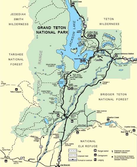
National Geographic publishes one Trails Illustrated Map for Grand Teton National Park. * The Grand Teton National Park Trail Map (map 202) covers the entire park, as well as portions of surrounding national forest lands. The map includes details such as backcountry campsite locations and points-of-interest. The map also includes UTM grids for use with GPS units, and has a scale of 1:31,680 and 1:80,000. * The Yellowstone National Park Map (map 201) covers the entire park, as well as portions of surrounding national forest lands. The map includes a detailed road network and popular trails, complete with use restrictions, mileages, elevation gains, and difficulty ratings. Popular attractions and park services are also clearly identified. UTM and Latitude/Longitude grids ensure ease of use with GPS or compass navigation. * Both the Grand Teton and Yellowstone maps can be purchased at a bundled price discount by clicking here. * All Trails Illustrated Maps are waterproof and tear-resistant. All trail maps and guide books for Grand Teton National Park and the surrounding region, including the Bridger-Teton, Shoshone and Caribou-Targhee National Forests, can be found here. |
 Grand Teton Trail Map |
|||
 Yellowstone Trail Map |
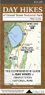
| Day Hikes of Grand Teton National Park Map Guide: Unlike a map that only shows you where the trails are, or a guidebook that only provides you with an encyclopedic list of hikes, this map guide was laid out to help you quickly decide which trails to explore, using distance, slope difficulty, as well as personal recommendations from Jake Bramante, the first person to hike every mile of trail in Glacier National Park in one season.
Jake has identified 48 hikes in Grand Teton National Park and has sorted them from best to least favorites. Trails are organized by distance on the guide side, and include brief descriptions for each trail. On the map side you'll find a complete list of hikes in ranking order, with indications for earlier season hiking, and hikes best suited for families. Each trail on the topographical map is color coded to indicate trail steepness. This trail guide is also waterproof and tear resistant. Jake also sells Day Hikes of Yellowstone National Park Map Guide. This map is similar in layout to the Grand Teton map guide, and covers 65 day hikes in Yellowstone National Park. |
 Grand Teton Map Guide |
Interactive Topo Map for Grand Teton National Park
(zoom in to view topographical terrain data)
View Grand Teton National Park in a larger map