Beauty Lake
| Trail Features: | Outstanding Views, Alpine Meadows, Flowers | 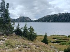 |
|||
| Trail Location: | Island Lake Recreation Area - Beartooth Hwy | ||||
| Roundtrip Length: | 6.3 Miles | ||||
| Trailhead Elevation: | 9482 Feet | ||||
| Total Elevation Gain: | 410 Feet | ||||
| Avg. Elev Gain / Mile: | 130 Feet | ||||
| Highest Elevation: | 9678 Feet | ||||
| Trail Difficulty Rating: | 7.12 (moderate) | ||||
| Parking Lot Latitude | 44.94291 | ||||
| Parking Lot Longitude | -109.53896 | ||||
Trail Description:
The hike to Beauty Lake begins from the Island Lake Recreation Area, located just off the Beartooth Highway (US 212) in Wyoming. The turn-off for Island Lake is located 12.1 miles east of the Beartooth Highway / Wyoming Highway 296 (Chief Joseph Scenic Byway) junction. It’s also 1.4 miles east of the Top of the World, an old general store and resort. After turning left (north) into the Island Lake Recreation Area you’ll pass a sign for the Shoshone National Forest before driving roughly three-tenths of a mile to reach the trailhead parking area. The trailhead is located on the opposite side of the parking area, or to the left of the boat ramp. Hikers should avoid blocking the boat ramp.
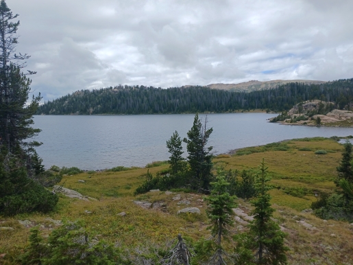
From the trailhead hikers will circle around the southern end of Island Lake to cross its outlet stream with the assistance of some easy rock hopping. During this initial stretch there will be a handful of social trails branching in from the nearby campground. Hikers should stay to the right at all junctions during this stretch to remain on the High Lakes Trail (#620). After crossing the outlet stream the trail begins traversing along the west side of the lake.
At just under nine-tenths of a mile the trail splits away from the lake to continue along a northerly course. Shortly thereafter hikers will reach Night Lake.
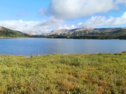
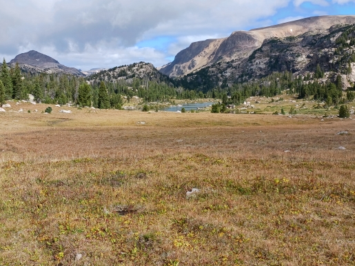
As with Island Lake, the trail travels along the western edge of Night Lake. There are several places along this stretch to relax and soak-in the views. In fact, much of the High Lakes Trail travels through open terrain that offers sweeping views of exceptionally beautiful subalpine meadows and the surrounding mountains. This includes 11,399-foot Lonesome Mountain, which is the prominent peak that can be seen looking towards the north-northwest for much of this hike. As a result of this terrain, hikers will be fully exposed to the sun, wind and any other weather conditions along this entire route.
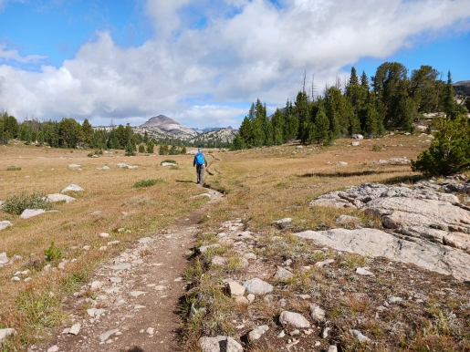
At 1.6 miles hikers will reach the northwestern tip of Night Lake. Up to this point the trail has gained very little elevation. Though it’s pretty easy to follow, there are one or two areas where you could possibly lose the trail for a brief moment. Simply use your intuition and you shouldn’t have any problems staying on the route.
Just beyond the lake hikers will pass a scenic tarn on the right. Over the course of the next two-thirds of a mile you’ll pass near several more unnamed lakes and tarns on either side of the trail.
AAt just over 2.8 miles the trail begins to make a sharp descent. After dropping roughly 125 feet in less than two-tenths of a mile the trail arrives at the Beauty Lake Trail (#621) junction. Hikers should turn left here to continue towards Beauty Lake. After walking roughly one-tenth of a mile you should notice a social trail branching off towards the lakeshore. This spur provides you with an opportunity to get closer to the northeastern corner of the lake. This spot also marks the end of this hike description. However, if you wish to explore more of the terrain in this area, including a view of Beartooth Butte, the Beauty Lake Trail continues along the eastern shore of the lake for more than a half-mile. Additionally, if you have two cars in your party, you could continue all the way to the Beartooth Lake Trailhead to make this a one-way hike of roughly 5.6 miles.
Finally, hikers should note that this trail travels through prime bear country, so be sure to bring bear spray and know how to use it.
Additional Resources:
* Shoshone National Forest website
* Lonely Planet Yellowstone & Grand Teton National Parks