Beehive Basin
| Trail Features: | Outstanding Views, Alpine Meadows, Flowers | 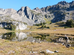 |
|||
| Trail Location: | Upper Beehive Basin TH - Big Sky, MT | ||||
| Roundtrip Length: | 6.6 Miles | ||||
| Trailhead Elevation: | 7925 Feet | ||||
| Total Elevation Gain: | 1450 Feet | ||||
| Avg. Elev Gain / Mile: | 439 Feet | ||||
| Highest Elevation: | 9360 Feet | ||||
| Trail Difficulty Rating: | 9.50 (moderate) | ||||
| Parking Lot Latitude | 45.30716 | ||||
| Parking Lot Longitude | -111.38418 | ||||
Trail Description:
The hike to Beehive Basin begins from the Upper Beehive Basin Trailhead, located in the Big Sky Ski Resort roughly 50 miles south of Bozeman, Montana. To reach the trailhead from U.S. Highway 191, turn west onto Route 64 and drive 10 miles to reach the Beehive Basin Road junction. After turning right here, and then driving another mile and a half, the narrow road makes a sharp descent down to the trailhead parking areas. At the bottom of the hill are two parking lots, located roughly 50 yards apart. Although there are technically two trailheads (or parking areas), the trails merge after a very short distance.
From the two parking areas the Beehive Basin Trail (#40) travels north. Throughout this initial stretch the route passes through private property before entering the Custer Gallatin National Forest.
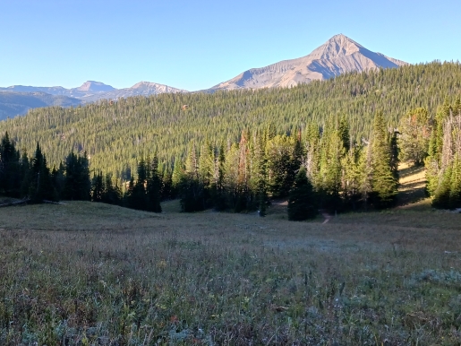
At eight-tenths of a mile the trail crosses over a footbridge, and then shortly thereafter begins climbing a series of switchbacks. At 1.25 miles you’ll arrive at the North Fork Trail #402 junction. You should turn left here to continue along the Beehive Basin Trail. If you look back towards the southwest at this point you’ll enjoy a great view of 11,167-foot Lone Mountain. Though it’s technically considered to be a volcano, scientists maintain that it has never fully erupted.
At just over 2.2 miles hikers will reach the Lee Metcalf Wilderness boundary.
At roughly 2.7 miles the trail begins to make a short, but steep ascent to reach the upper basin. After topping out, hikers will begin traveling along nearly flat terrain.
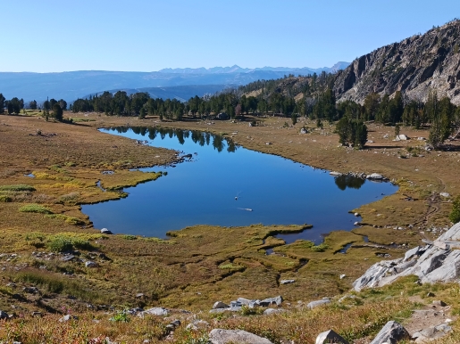
At just over 3 miles hikers will arrive at the south end of an unnamed lake, which is actually the main feature of this hike. This beautiful jewel rests in an alpine basin below the rugged Spanish Peaks. During the summer months the meadows that surround the lake are filled with a plethora of wildflowers. You should note that this is not Beehive Lake. Beehive Lake lies on the other side of Beehive Peak, which is the dominate mountain rising above the unnamed lake towards the northwest.

Though you could end your hike here, and be fully satisfied with the beautiful scenery from this vantage point, I highly recommend continuing for another quarter of a mile to the bluff above the far end of the lake. The trail continues by following along the west side of the lake before ascending the draw that rises above the northern shore. From this vantage point you’ll enjoy a spectacular view of the entire upper Beehive Basin area. For even better views you’ll have the option of continuing just a little further up the trail to circle around the prominent rock bluff that rises directly above the north end of the lake. Hikers will have to go off trail and briefly bushwhack to reach the overlook, but the route is apparent and very easy to navigate.
Hikers should note that this is an extremely popular destination. It’s best to arrive early if you wish to avoid the crowds along the trail, and at the lake. You should also note that you’ll be traveling through bear country, so it’s best to carry bear spray, and know how to use it. Just a few days before hiking this trail a hunter was badly mauled by a grizzly bear on the Yellow Mule Trail, which is located only a few miles away.
Additional Resources:
* Custer Gallatin National Forest website
* Lonely Planet Yellowstone & Grand Teton National Parks