Sheepherder Lakes
| Trail Features: | Outstanding Views, Alpine Meadows, Flowers | 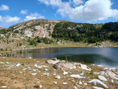 |
|||
| Trail Location: | Forest Road 1522A - Beartooth Highway | ||||
| Roundtrip Length: | 4.2 Miles | ||||
| Trailhead Elevation: | 9708 Feet | ||||
| Total Elevation Gain: | 250 Feet | ||||
| Avg. Elev Gain / Mile: | 119 Feet | ||||
| Highest Elevation: | 9940 Feet | ||||
| Trail Difficulty Rating: | 4.70 (easy) | ||||
| Parking Lot Latitude | 44.94099 | ||||
| Parking Lot Longitude | -109.51195 | ||||
Trail Description:
The hike to Sheepherder Lakes begins from Forest Road 1522A, located just off the Beartooth Highway (US 212) in Wyoming. Forest Road 1522A is located 13.4 miles east of the Beartooth Highway / WY Highway 296 (Chief Joseph Scenic Byway) junction. Unfortunately there isn’t a formal sign for this short side road, only a tiny side marker that becomes visible after turning onto the road. You may want to note that Top of the World, an old general store and resort, is located roughly 2.7 miles west of FR 1522A. After turning left (north) onto FR 1522A drive another tenth-of-a-mile to reach the end of the road where you’ll find a decent size parking area.
While there isn’t a proper road sign indicating your turn, neither is there any type of signage for the trailhead. In fact, you can’t even see the trail leading to Sheepherder Lakes from the parking area, at least at first glance. No worries, look towards the northwest (or towards the left as you approach the parking area) and you’ll notice some large boulders blocking the road. This is almost opposite from the large lake (Long Lake) that’s visible towards the east. On the other side of those boulders the old dirt road continues. The hike begins by briefly following this road. After walking about 50 feet or so you’ll notice a pull-out branching off towards the right, and then almost immediately a faint trail stemming from that pull-out. This trail leads towards a copse of trees that lie directly west of the tarn that can also be seen from the parking area. Hikers should follow this trail, which becomes much more well-defined after a very short distance.
At two-tenths of a mile the trail crosses over Little Bear Creek, and shortly thereafter you’ll arrive at Dorf Lake, which provides some fantastic views of the surrounding area. From here the trail skirts around the west side of the lake. Portions of this stretch can be a little boggy at times, depending on recent weather conditions.
At roughly three-quarters of a mile the trail passes above an unnamed lake on the right.
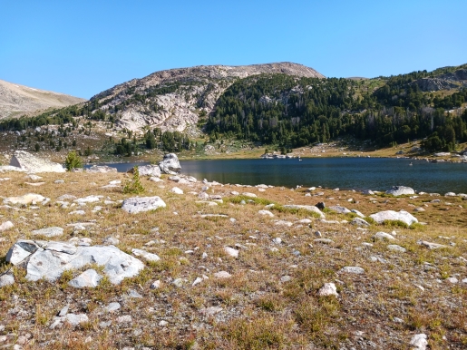
At just under 1.7 miles hikers will arrive at Lower Sheepherder Lake (photo above). Up to this point the trail has been mostly well defined. Although there are a couple of spots where it becomes a little faint, the trail is easy to follow. Beyond the lower lake, however, hikers will need to do a little more route finding. As you travel past Lower Sheepherder Lake the trail becomes much more unclear, is difficult to read in some cases, and disappears altogether for short distances. This portion of the hike also makes a relatively gentle ascent through a boulder field. Although it may look or sound intimidating, it really isn’t. Simply use common sense and keep the connecting creek between the two lakes to your right, and you’ll soon arrive at (upper) Sheepherder Lake. This segment of the route heads in a north by northwesterly direction to reach Sheepherder Lake, which lies in an absolutely beautiful basin below the towering mountains towards the north.
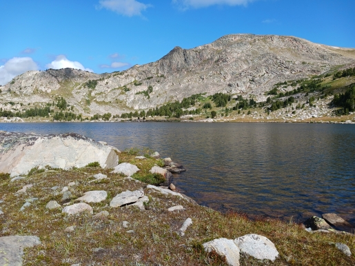
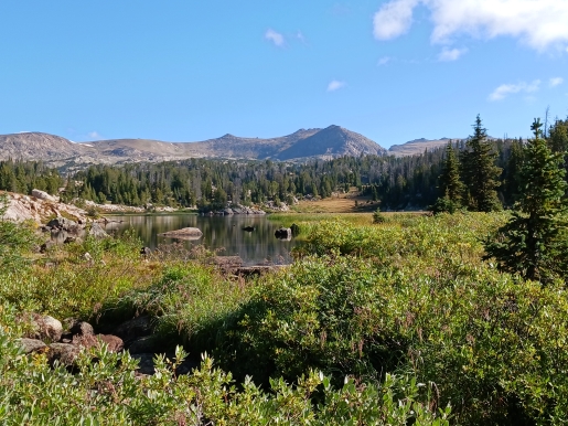
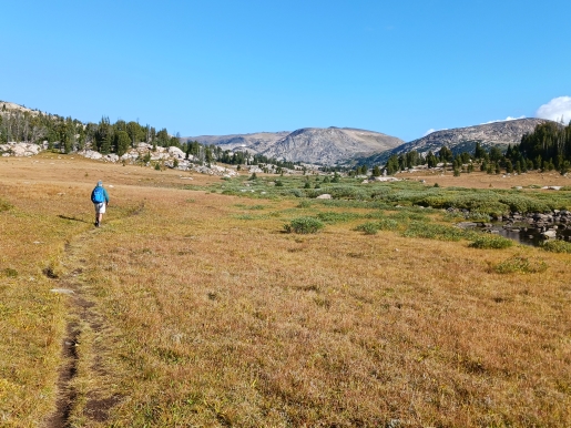
The entire valley, or basin, in which this route travels through, is exceptionally beautiful. There are numerous spots at both lakes to soak-in the outstanding views. Because the entire route travels through open terrain, hikers will be fully exposed to the elements during the entire trip. Hikers should also note that this trail travels through prime bear country, so be sure to carry bear spray, and know how to use it. If you're uncomfortable with minor route finding I would also recommend bringing a good topo map.
Additional Resources:
* Shoshone National Forest website
* Lonely Planet Yellowstone & Grand Teton National Parks